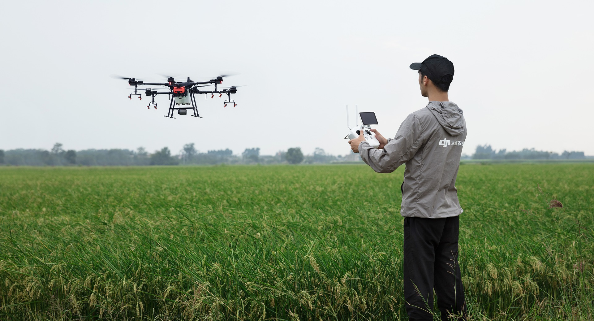
With technology upgrades and easy to use features, drones are easier than ever to use.
When it comes to using drones for farming and small plot agricultural research trials, there has been some misconceptions over the years. Technology upgrades though have made drones easier to use and even given those working in ag more options to utilize them.
“There’s so much that you can do with this technology outside of the growing season,” John Scott, Purdue extension coordinator for digital agriculture with the Wabash Heartland Innovation Network, says in the Feb. 16 episode of Seed Speaks. “Getting up there and looking at your crop gives you a whole another perspective that we just simply don’t have being down here on the ground. And it’s so much faster. I can scout a field. It’s a 50-acre field and in 24 seconds I can get a general idea on what’s going on.”
Scott adds drones can be used to monitor field conditions such as residue and water movement, and grass waterways out of the growing season.
It’s also easier now to use drone image processing software. In the past it would take hours, if not days, to stitch together multiple images to make a map, or you might even have to send it to someone else to do on a supercomputer and then download the map.
“The software has come a long way in the last couple of years. It’s at the point now where even if you have 1,000 photos, you can stitch those into a map in like 10 to 15 minutes on a regular laptop with no internet connection,” Anthony Hearst, CEO of Progeny Drone Inc., says in the episode.
You also don’t need to always work through a third party to get data from the drones. Software programs for regular laptops are available to buy which allow farmers and ag researchers to stitch together images and make maps themselves using drone images, Hearst adds.
Improvements in the software have also dramatically reduced the cost of the drones and cameras needed. Hearst explains people may think you need an expensive camera or really accurate GPS on the drone, but that’s not necessary, at least not for small plot research as he works with.
“Even for your basic scouting and finding problems, and even doing things like stand counts on large fields, I don’t think that level of positional accuracy is usually necessary,” Hearst says.
Future Opportunities for Drones in Ag
There’s still a way to go with drones and more opportunities for how they can be used. Drones have yet to be used for precision spraying, but both Scott and Hearst agree there’s opportunity there.
“I’m getting a lot of questions around, ‘How do I spray with this? What are the regulations I need to fulfill to spray fungicide with this?’ This is the big one that I work with a lot of folks on. They see the potential for some of the efficiencies there. And there’s a lot of chatter around that in this space today,” Scott says.
Hearst sees potential for 3D mapping using drones. He explains maps could be made to show the height of the vegetation throughout a field in a small plot trial or to pinpoint in a crop such as canola when it hits a certain flowering percentage.
“That’s a very labour-intensive metric right now. And it should be straightforward to do with drones. And I think if you just had a software that would let you basically say, ‘Okay, here’s the colour of my flowers, find them for me, tell me how many flowers there are in my plots.’ I think things like that are really doable,” he adds.